|
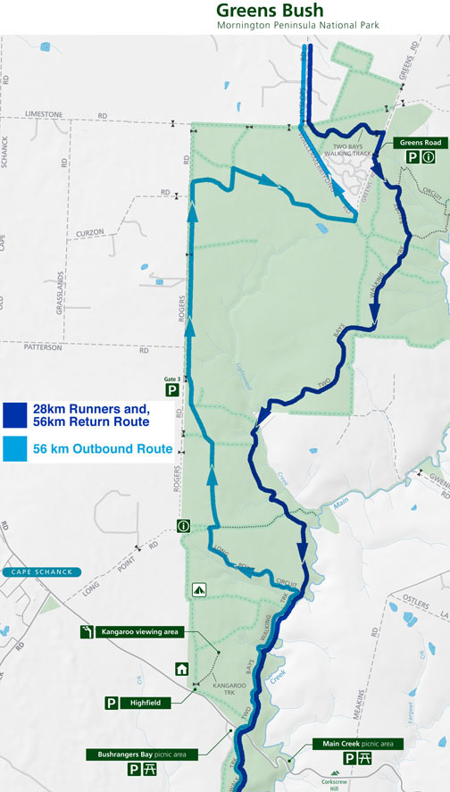
Download the Map
The Trail is
generally well marked, but if you don't
understand GPS devices, you really need to
look at the Parks Vic map from the download
link above. If in doubt about the directions
just follow the blue wren signs. These blue
wren signs indicate that you are on the Two
Bays Trail.

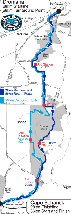
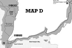
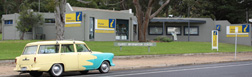
From the
information centre go along Point
Nepean Highway away from Melbourne (the bay
will be on your right)
turn left
onto Latrobe Parade and continue up the hill
and across the bridge over the freeway
turn left
onto Bunurong Track
15 metres in
you will see another Track head on your
right
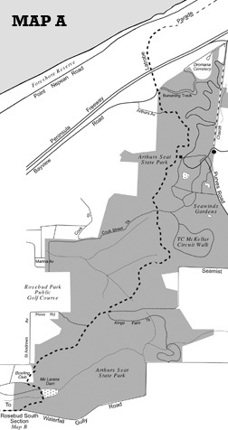
go up the
track and climb the steep track up to the
top of Arthurs Seat
follow the
sign towards Seawinds
EXCEPT the
last sign which reads Seawinds 0.3km.
At this sign you should take directions
right to Waterfall Gully Rd.
follow the
sign right to "McLarens Dam 1.4km"
go right to
"Waterfall Gully Road 2.8km"
DO NOT
follow the sign to Seamist Drive
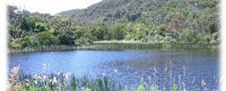
take the
short cut down to McLarens Dam
at the
bottom of the hill, got to the left briefly
to go past the Dam. The dam will be on your
left. Veer right up the hill
the Urban
section Begins
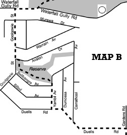
turn right
at Waterfall Gully Road (There are safe
water taps in the gardens here)
Turn left at
Goolgowie Road
keep running
along Goolgowie Road
turn left at
Avalon Drive then..
sharp right
10 metres in
run through
the reserve on the boards past the kids
playground
and out onto
Yambil Ave where you turn right.
run to the
roundabout where you will see the Peninsula
Sands sign and turn left along Duells Road
(water in garden taps here)
stay on
Duells Rd all the way until Gardens Rd (Road
reserve- no actual road)
go right and
wipe your feet on the brushes provided.
past the
monument to the track visionary
down the
hill, stay on the track
cross over
Browns Rd. Into Hyslops Rd on the other side
(unsealed)
run all the
way up Hyslops Rd
eventually
Hyslops Rd thins out to a track go straight
ahead
follow the
sign to "Cape Schanck 15.8km"
follow the
sign left to Greens Bush and in about 50m
take the track on the right. (marked with a
faded blue wren).
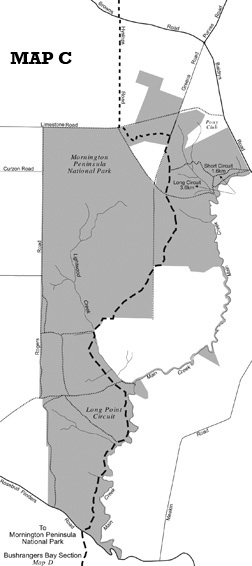
run through
Greens Bush.
right when
you get to Greens Road
you will
come into a clearing. You are in Greens Bush
go towards
the large Greens Bush sign
through the
gate and past the information shelter
(13.4km to the Cape)
the next 8km
is straightforward stay on the track. Make
sure you are following the signs to Boneo Rd
or Cape Schanck
you will go
through beautiful mixed and rolling terrain
when you get
to Boneo Rd watch for traffic. Cars have
right of way.
(5.4km to
the Cape)
go towards
Bushrangers Bay and follow the track to the
Cape (some small sections are sandy)
keep going
for what seems an eternity (starting to feel
it)
eventually
you will rise up a small undulation and
you'll see the lighthouse
run towards
the lighthouse
into the
carpark, past the toilet block (water in the
toilets is bore water- don't drink it.)
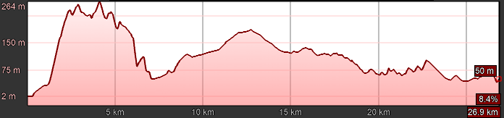
the 28km run
finishes in the Bus Lane at Cape Schanck.
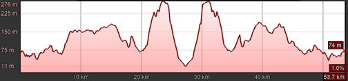
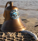
| 56km
runners ring the bell at their
turnaround point in Dromana. (make it
a performance!) |
|
|